Mountain Paths in M. Tempi
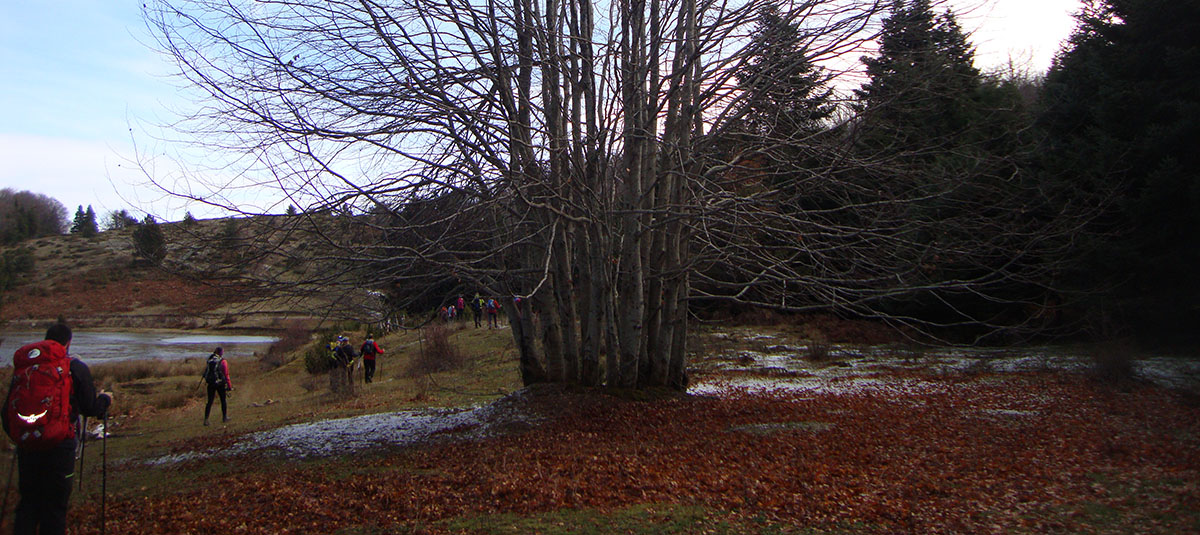
The activity of Mountain Hiking is aimed at those who love walking in nature, especially the mountainous.
The Tempi Municipality presents such a diverse structure that satisfies both the simple hiker and the trained climber.
The main purpose is physical exercise, spiritual well-being and generally pleasure and entertainment, through the movement, the enjoyment of natural beauty and the spherical experiential knowledge of the area, in which a hiking trail evolves.
Castle of Oria – Ampelakia
ROUTE: N. R. – Castel of Oria - Prophet Elias – Ampelakia, 5,5 km.
ROUTE TYPE: mountain hiking, in low vegetation
ALTITUDE: 300 m.
STARTING POINT: 385,5 km parking N.R.
DURATION: 2 hours
Most of the trail, you find yourself in high vegetation to the Castle, with very good signage, which does not require any special attention. The view of the valley from Castle is fantastic.
Spilia - Shelter N.R. LARISA
ROUTE: Spilia 850 m.- Shelter N.R. 1600 m. 5 km.
ROUTE TYPE: -
ALTITUDE: 750 m.
STARTING POINT: Spilia 850 m.
DURATION: 2.5 hours
The shelter has a capacity of 46 people with full equipment and heating. In the shelter, at the bottom west, there is an emergency room when it is closed.
Itea - Prophet Elias - Rapsani
ROUTE: Itea's St.Panteleimonas - 100 m.- Prophet Elias - 500 m.- Rapsani- 600 m.
ROUTE TYPE: Hiking in low vegetation
ALTITUDE: 500 m.
STARTING POINT: Tempi - Itea's St.Panteleimona
DURATION: 2.5 hours
Beautiful path to the traditional settlement of Rapsani.
Spilia – Sinachovrisi - Anatoli
ROUTE: Spilia 850 m.- - Anatoli 15 km.
ROUTE TYPE: Low vegetation, fir and beech forest
ALTITUDE: 700 m.
STARTING POINT: Spilia
DURATION: 4.5 hours
Beautiful path to the village of Anatoli Agias.
Itea - Tempi - Rapsani's Station (Kleftiko)
ROUTE: St.Panteleimonas – Rapsani's Station 10,5 km.
ROUTE TYPE: Mountain hiking. (Rural 4,5 km., path 6 km.)
ALTITUDE: 320 m.
STARTING POINT: Itea's St.Panteleimonas - 100 m.
DURATION: 3.5 hours
However, the view from above, beside the rocky cliffs, presents a further image, with a different sense of enjoyment. The flow of Pinios river from Thessaly plain to the entrance of the valley, the opposite side of Kissavos with the castle of Oria, the historic Ampelakia, Agia Paraskevi with the hanging bridge low on our feet, the bridge of Pinios and the river leaves to the sea between villages in a green plain and the coasts of Thermaikos and Chalkidiki create an idyllic walking trail.
Rapsani - Kallipeuki
ROUTE: Rapsani - Kallipeuki 14 km.
ROUTE TYPE: Low vegetation - spruce (1 km. rural – 4 km. sylvan)
ALTITUDE: 600 m.
STARTING POINT: Rapsani 600 m.
DURATION: 4 hours
There, on an experimental basis, in Greece, the ideal vineyard, for products of excellence that respect the environment. It has an excellent view of Kissavos, Tempi and Chalkidiki. It is also a holiday village known for its dry climate during the summer months.
Krania - Pori
ROUTE: Krania – Pourlia 10 km.
ROUTE TYPE: Low vegetation
ALTITUDE: Crossing
STARTING POINT: Krania
DURATION: 3.5 hours
A holiday village with view to Kissavos, the coast of the prefecture of Larissa, the delta of Pinios, Thermaikos and Halkidiki.
Spilia – Ampelakia
ROUTE: Spilia - Ampelakia 18 km. (4 km. sylvan)
ROUTE TYPE: low vegetation - forest
ALTITUDE: 300 m.
STARTING POINT: Spilia 850 m.
DURATION: 5.5 hours
Beautiful autumn path to the historic Ampelakia and tour of the traditional village.